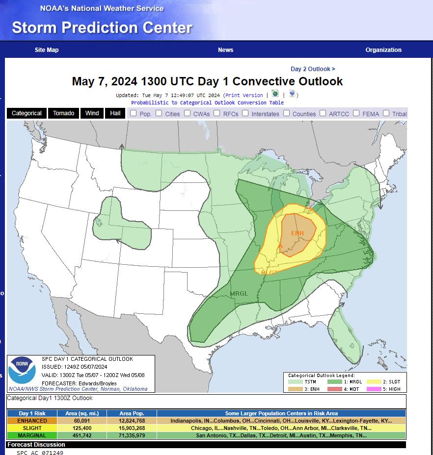
SPC Upgraded the Moderate Risk Area.
Another night-time event.
Major metro areas:
Indianapolis
Louisville
Cincinnati
Columbus
Dayton
Toledo
Lexington
Shoreline South-end of Lake Michigan
Stay tuned for updates.
www.spc.noaa.gov/products/outlook/day1otlk.html
Day 1 Convective Outlook
NWS Storm Prediction Center Norman OK
1210 AM CDT Tue May 07 2024
Valid 071200Z – 081200Z
…THERE IS AN ENHANCED RISK OF SEVERE THUNDERSTORMS ACROSS THE OHIO
VALLEY…
…SUMMARY…
Scattered severe thunderstorms are expected across the Ohio Valley
today. A few tornadoes, potentially strong, large to very large
hail, and severe/damaging winds all appear possible.
No break today and tomorrow as the atmosphere loads up for 2 more very busy days with ALL SEVERE HAZARDS POSSIBLE over large USA regions. Today starts active and ends active. Below the latest SPC TORNADO probabilities for today and tomorrow. Remember SPC tweaks these as new… pic.twitter.com/LpmfVnKUgs
— Jim Cantore (@JimCantore) May 7, 2024
7:51am CDT #SPC Day1 Outlook Enhanced Risk: over parts of Indiana, Ohio and northern/central Kentucky t.co/TgJgC6cQZw pic.twitter.com/zdNlrMpvWE
— NWS Storm Prediction Center (@NWSSPC) May 7, 2024
h/t DOORBERT