Saw a moderate helicity Hot Tower fire offshore Galveston early this morning.
Conditions are conducive for further development: 4000 CAPE and a shear gradient.
ICON has this spinning up.
Stay tuned for updates.
Convection starting to go to town.
Looking very interesting.
Could catch a lot of people by surprise.
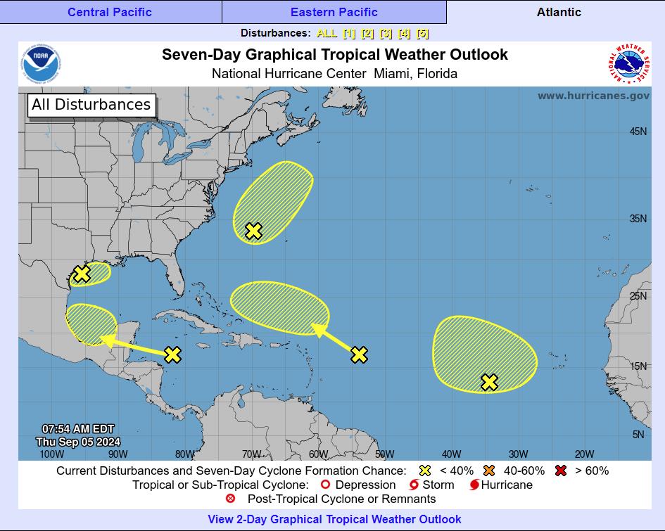
Tropical Weather Outlook
NWS National Hurricane Center Miami FL
800 AM EDT Thu Sep 5 2024
For the North Atlantic…Caribbean Sea and the Gulf of Mexico:
1. Northwest Gulf of Mexico:
A trough of low pressure is producing widespread disorganized
showers and thunderstorms across the northwestern Gulf of Mexico,
including near the coasts of Louisiana and Texas. Upper-level
winds are expected to become less conducive for development by
Friday and Saturday as a frontal boundary approaches the system.
Although development is unlikely, heavy rainfall is expected
across portions of the northern Gulf Coast during the next day or
so.
* Formation chance through 48 hours…low…10 percent.
* Formation chance through 7 days…low…10 percent.
https://www.nhc.noaa.gov/gtwo.php?basin=atlc&fdays=7
Broad rotation evident on radar
Looks like its going ballistic
https://www.tropicaltidbits.com/sat/satlooper.php?region=gom&product=ir
This is pretty amazing: the ocean heat content averaged over the Gulf of Mexico is obliterating previous all-time record highs. It's 126% of average for the date.https://t.co/CdrzWVvKiZ pic.twitter.com/rciwFvJ8Zx
— Brian McNoldy (@BMcNoldy) September 4, 2024
At this exact moment in 2017, Hurricane Harvey was explosively intensifying in the western Gulf of Mexico, ultimately going from a Tropical Depression to a Category 4 Hurricane in just 40 hours. pic.twitter.com/lEj1VheSQL
— Backpirch Weather (@BackpirchCrew) August 25, 2024
h/t DOORBERT