Tropical Weather Outlook
NWS National Hurricane Center Miami FL
800 AM EDT Fri Aug 2 2024
For the North Atlantic…Caribbean Sea and the Gulf of Mexico:
https://www.nhc.noaa.gov/gtwo.php?basin=atlc&fdays=7
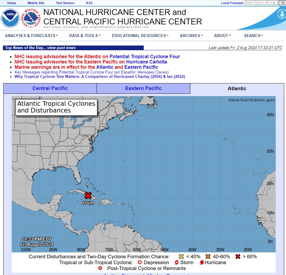
1. A well-defined tropical wave is producing a large area of poorly
organized showers and thunderstorms over eastern Cuba, Hispaniola,
the southeastern Bahamas, and Jamaica, as well as the adjacent
waters of the southwestern Atlantic and the Caribbean Sea. The wave
is expected to move near or over Cuba throughout the day and then
emerge over the Straits of Florida tonight or Saturday.
Environmental conditions are expected to be conducive for additional
development after that time, and a tropical depression is likely to
form this weekend over the Straits of Florida or eastern Gulf of
Mexico near the Florida Peninsula. Tropical storm watches or
warnings could be required for portions of Florida later today.
Regardless of development, heavy rains could cause areas of flash
flooding across Florida, Cuba, and the Bahamas through the weekend,
and interests in these locations should continue to monitor the
progress of this system. A NOAA Hurricane Hunter aircraft is
scheduled to investigate this system later today.
* Formation chance through 48 hours…medium…60 percent.
* Formation chance through 7 days…high…90 percent.
https://x.com/_/status/1819330196232618175
Just saw NHC update to TD4
…DISTURBANCE LOCATED OVER EASTERN CUBA… …TROPICAL STORM WARNINGS AND WATCHES ISSUED FOR PORTIONS OF FLORIDA…
Slow development is possible while the system is over Cuba, and the
system is likely to become a tropical depression soon after it
moves offshore. The environment over the Gulf of Mexico is quite
favorable for strengthening with light shear and very warm
sea-surface temperatures, so subsequent steady strengthening is
expected. The two biggest uncertainties in the intensity forecast
are how long the system will remain offshore of Florida and how
long it will take to consolidate. The system is likely to weaken
as it crosses Florida, with re-intensification likely over the
Atlantic.
https://www.nhc.noaa.gov/text/refresh/MIATCDAT4%20shtml/021459.shtml
h/t DOORBERT