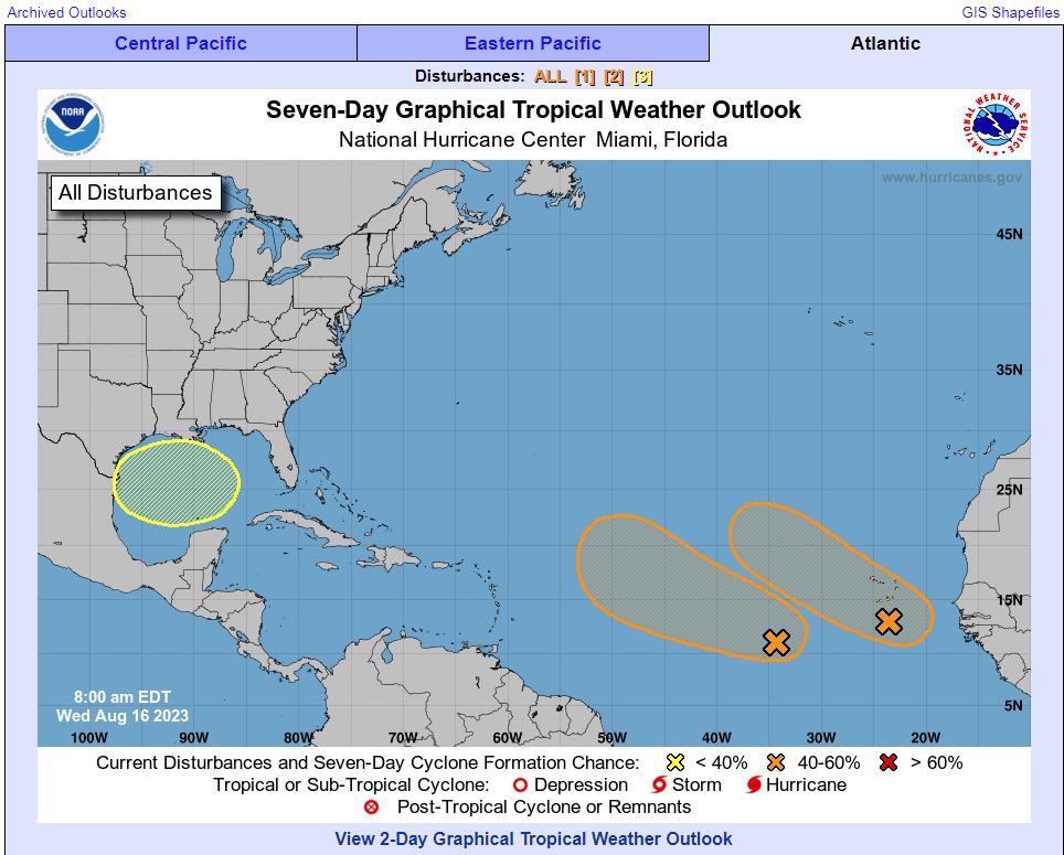
Western Gulf of Mexico:
A broad area of low pressure could form in the central or western
Gulf of Mexico by the beginning of next week. Some slow development
of this system is possible thereafter as it moves westward and
approaches the western Gulf of Mexico coastline by the middle of
next week.
* Formation chance through 48 hours…low…near 0 percent.
* Formation chance through 7 days…low…20 percent.
https://www.nhc.noaa.gov/gtwo.php?basin=atlc&fdays=7
Latest EURO ensembles showing our low pressure area inching closer to Florida this weekend with a trek westbound and down into early week. Could up some rains/storms/waves in the forecast at the minimum. Something to watch for sure along the whole Gulf region.… pic.twitter.com/jx3kzxX0ji
— Mike's Weather Page (@tropicalupdate) August 16, 2023
The National Hurricane Center is currently monitoring an area for potential development early next week. Residents should continue to closely monitor the forecast over the next several days. #txwx #rgvwx pic.twitter.com/Hc6nAwSE0T
— NWS Brownsville (@NWSBrownsville) August 16, 2023
h/t DOORBERT